The trip undertaken by the LRD was an assessment tour of their Integrated Watershed Management Programme (IWMP), a government of India initiative implemented countrywide under the Pradhan Mantri Krishi Sinchayee Yojana (PMKSY) scheme. Under the watershed development programme, the LRD also had a sub-project: Special Programme for Economic and Environmental Development, better known as ‘SPEED’, a five-year programme. The individuals working under these projects are known as the Watershed Development Team (WDT) members
A more concise article (official report) of the trip and their assessment can be read HERE

On our way to Noklak, we crossed a police checkpoint in Chendang Saddle where the convoy stopped to catch a breather. It should technically not have been more than a two-hour journey but I reckon it was more because of the road conditions.
Chendang Saddle is the halfway mark. The road on the left takes you to Noklak while the right takes you towards Shamator.
Shamator was initially one of the stops listed down for the visit but due to a feud between the Yimchungar – Tikhir tribe, the road was closed and the Saddle intersection had heavy security personnel manning the area. The Yimchungar – Tikhir feud was the oldest story in the book: Land rights. Both claim that it’s their land and in the end, result to havoc or far worse, criminal acts. This feud, however, was not new or recent.
There is a less publicised annual ‘festival’ which is way older than the Hornbill Festival describable as “Yimchungar / Tikhir Slug-fest”. It is an unending saga of a relentless struggle by the Tikhirs for their separate identity from the Yimchungar Tribe which has caused bloody skirmishes and loss of lives over the years along the way. It is a complex high tension emotionally charged confrontation that has been recurring every year for the past couple of decades and has consistently caused law and order situation in Tuensang and Kiphire Districts.
Khekiye K. Sema, Retired IAS, Nagaland Post Op Ed, January 2016
I was conveyed a message and ‘asked’ not to take photographs. Had I not been in the company of the government number plated vehicles, I reckon the message would’ve been far harsher. A Yimchungar church lay deserted without any members on a small hillock as they had all been chased out from Saddle too, which is a Tikhir dominated village.

From this point on that we all lost phone connectivity so flight mode was on for battery conservation because electricity too was going to be a valuable commodity as we got travelled further into the district. We would have no further news of the dispute and would be greeted on the way back by more armed guards and stopped for a check (regardless of the number plate).
We had reached Noklak by 10:00 – 10:30AM and were approached by some of the WDT members (remember we were travelling with a team that were actually supposed to work!) if we wanted to go to one of the India – Myanmar borders, the bordering village called Pangsha. As we were not required to the official meeting that was set up in the nearby village Nokyen-B (the purpose for the overnight stop at Noklak), six of us, a driver and a local started off for the one-hour trip to Pangsha.
While the village is called Pangsha, the border point is called ‘Dan’, also known as the ‘International Trade Centre’ (ITC). There are said to be five border points from Nagaland to Myanmar and these ITC’s are where people from Myanmar come to trade. They mostly remain shut unless an important or well-known official is visiting. What we heard was this: when they get the news of an important visit, someone runs across the border to convey the news and a trade centre is quickly set up. There was a deserted looking rest house which was the ITC area.
Myanmar was basically just a mountain away. You just needed to cut across the mountain. And that’s what people do. These may be international borders but they are very rarely checked which means that people from both ends make frequent visits. From Noklak and beyond, we got used to seeing a certain kind of bikes on the road. They looked like 50 cc bikes but imagine it more stripped down. Right down to the basic minimum. The locals called them “Burma bikes” because they were just that. These lithe bikes were as sturdy as ATVS and were extremely enduring. Enduring enough to make their way from the borders of Myanmar into Tuensang. We later learned that they were cheap and affordable and many locals save up money to buy one.
Our journey back to Noklak was eventful to say the least with the car breaking down.


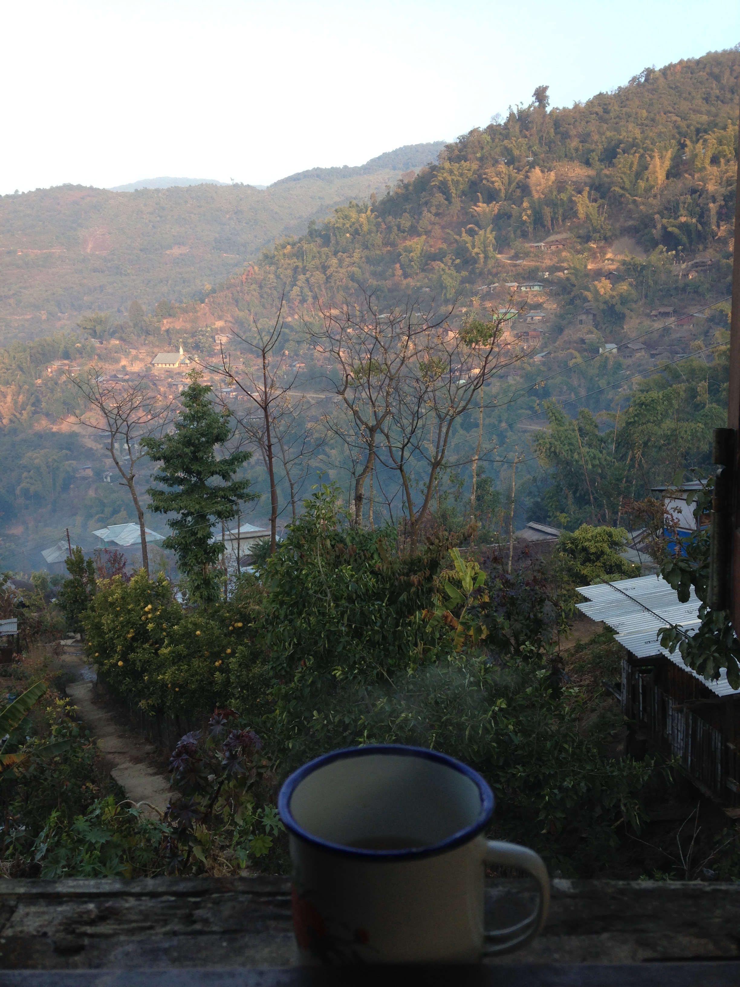


Our next stop from Noklak was Kengjung (also Kingjung) via Sanglao and in Kengjung, we met a pastor who gave us some more insight about these travels to Myanmar. The journey to Sanglao where we stopped for lunch was quite an experience. We left Noklak at 7:00AM stopping half an hour before reaching Sanglao to survey a plantation. During this pitstop, we (Debbie and I) were stunned. The grounds and the side of the road was blanketed in snow. It did get excessively cold but there was no way were prepared for snow. Sanglao was at 2030 meters above sea level and this was the coldest phase of the entire trip. This region was on the windward side of the mountain hence, received minimum or no sunlight.
We were also spectators to a herd of ‘Mithuns’ (also called Gayal or Bos Frontalis) which are quite prominent in the region. Mithuns are said to have a weakness for salt. Even in a field of 1000 Mithuns, if you feed your Mithun salt, he will return to you. Salt is said to cement a bond between man and beast. Alternately, feeding a Mithun a large quantity of salt before slaughtering him makes the meat tastier. Personally, I’d rather not do the latter because I’m not too pro meat.
We reached Kengjung around 1:00PM and were greeted the way every stereotypical tourist visiting Nagaland would like to be greeted: In full traditional gear, dancing and singing and the Naga version of yodelling. Reaching Kengjung was not an easy task. It’s not an understatement when someone says how bad the roads in Nagaland are but this was different. To begin with, the so-called roads that were treaded on were constructed just a few years earlier. Before that, it was only accessible by foot which basically translates to crossing a mountain (casually). In fact, two of the WDT members assigned to Kengjung did exactly that a few years earler and got lost in the middle of the jungle, at night. They did the only thing they could do: make noise until kingdom come. Luckily, a few villagers were out hunting and came to rescue them and took them to the Pastor’s house. Geographically, speaking, also mentioned earlier, the positioning of the landscape didn’t help. While the village of Kengjung is located on a higher altitude with direct sunlight, the (windward facing) mountains and the roads carved out through them got zero sunlight. It remained damp throughout the year and during the monsoons, it becomes slush and mud making it impossible for vehicles to pass through.
The Land Resource Department were here to inaugurate a guest house and their officials were probably the first officers to visit the village which for the village council and also the villagers is a big deal. Like so many (or mainly all) other states in India, rural Nagaland is heavily dependent on their government to bring in development and changes. On the one side, you look at the villages and see how desperately they need the help. Kengjung has a population of 1035 people with 211 households and they have barely 10 matriculates. But on the other side, when you begin to start developments, people start look for handouts. When I say they are dependent, they feel that they are owed the help. On the side of the government, that’s the struggle. How do you get them out of that mentality? According to the officials, it will take time but if changes are to take place, you must take the steps which is why in every speech, all three officials (Director and Deputy Directors) pressed on the issue of meeting halfway; that it was a give and take relationship: If the government is willing to come 60%, the village in discussion should also be able to meet them 40%. So even if the village cannot come up with the full required funds, they can contribute in terms of man power and other resources that are available to them. Over the last couple of years, there has been some tremendous success with the villages under their special SPEED project.
Of the villages we visited, Longkhitpeh (pronounced Long-ki-pi) and Kengjung were by far the most impressive. But I wouldn’t get into the details of that here. I don’t want you to read things you don’t want to but if you’re interested, you can read the published piece about this trip because I wrote about all the significant developments that were implemented by the department.
Debbie and I had the evening to explore so we decided to go for a short hike to a neighbouring mount. It’s close enough, we said. We can do it. Turns out, it wasn’t close enough. But we did it. We got a view of the village and we also saw the path that is taken by the villagers to go to Myanmar. Yet another casual walk. After we ascended, we went to interact with some of the WDT members and in turn, visited the Pastor and his wife. Over cups of black tea by the fire in the dimply lit traditional kitchen and a few cats beside us, we asked him about the trail to Myanmar.
Kengjung is one of the furthest villages in not just Tuensang but Nagaland. While it is one of the border villages, it is not an ‘ITC’ like Pangshah. The closest Burmese town while crossing over from Kengjung is called Kamdi which you reach after crossing what is known as “Osi” post. We learned that there are more Khiamniungans in Myanmar than in Tuensang. Some in Tuensang have their families in Mynamar. For this reason, there are two (Khiamniungan) representatives in the Burmese Parliament. There is also a Khiamniungan Association Centre in Kamdi. Most importantly, you do not require an ID while crossing the border. Trading seems to be easily possible as the Burmese in Kamdi can speak a basic version of the Khiamniungan dialect. The pastor told us that it takes him 11 hours to reach the border but for others (like us), it would probably take a full day and a half, he said with a weak smile. I have a feeling he thinks that we wouldn’t even be able to do it! The pastor also relayed the information that the best way to travel in Myanmar was by boats through the Chindwin river. The cost is calculated by the distance. I think I remember him mentioning that he has travelled till Mandalay.
There is a possible chance that I might have gotten some of the names wrong as upon searching for verification, I was unable to come up with some of the facts. Either these facts and places are negligible that it hasn’t been recorded or I definitely misheard. Or there’s another reason: that no one’s travelled to that point to fact check. Whichever the reasoning, it was interesting to learn of them.
That night, the villagers in Kengjung were ready for a celebration. Apart from the food that was presented and a group of very talent school boys singing for our entertainment, we also had the chance to drink some Burmese beer. Clearly there were other forms of alcohol present which meant that waking up in the morning proved to be difficult for some but they sure hid it well in front of their bosses!
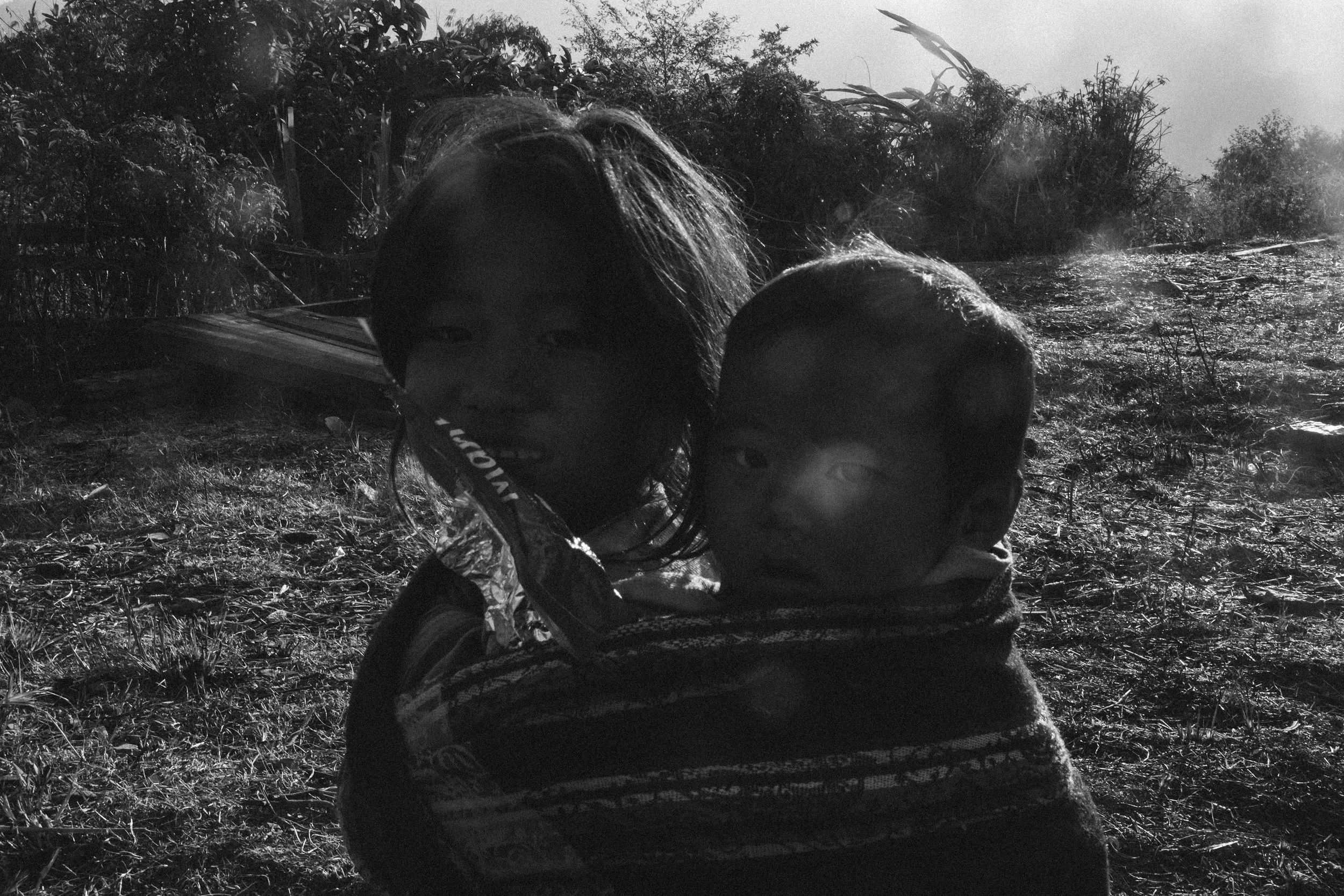


Debbie and I took a final walk around the village. Witnessing the break of daylight and the first rays of sunlight was magical. Debbie wanted to give some sweets and biscuits to the kids something she had done throughout the trip (something I started labelling as "social service" because that was her background). Me doing that just looked funny mostly because I am awkward around children. So I made her do that and I just took the pictures. I strayed a little to meet a little girl, her tiny brother who she was carrying on her back and a curious little, pant-less soul. I had some biscuits with me so I smiled trying to make them feel at ease (because they are mostly always very shy and wary). My camera was with me and I clicked a picture of the two of them. I think it was the first time the little had seen a camera because to him, that was the spawn of satan! He was completely taken aback by it and started crying. I basically took another picture and showed it to him hoping that would calm him down. It did subdue the panic but he was still very apprehensive about it. I went back to where Debbie was (mostly for cover from children I admit!) and we walked through a field of five little boys playing football with an extremely worn out, tattered ball and instantly decided to join them for the game. They were apprehensive at first but within a few minutes, decided to take up head on. Probably not brag worthy but I did fight off three of them and scored a goal. They were definitely united against the outsiders.
Who knows if we’ll ever return but football at 2000 meters above sea level at the first light of day? If that wasn’t a way to remember Kengjung, I don’t know what is.
JANUARY 11 - 17, 2016